Lerwick
Lerwick is the main town and port of the Shetland Islands, Scotland. Shetland's only burgh, Lerwick had a population of about 7,000 residents in 2010. Centred 123 miles (200 km) off the north coast of the Scottish mainland and on the east coast of the Shetland Mainland, Lerwick lies 211 miles (340 km) north-by-northeast of Aberdeen; 222 miles (357 km) west of the similarly sheltered port of Bergen in Norway; and 228 miles (367 km) south-east of Tórshavn in the Faroe Islands.
History
Lerwick is a name with roots in Old Norse and its local descendant, Norn, which was spoken in Shetland until the mid-19th century. The name "Lerwick" means bay of clay. The corresponding Norwegian name is Leirvik, leir meaning clay and vik meaning "bay" or "inlet". Towns with similar names exist in southwestern Norway (Leirvik, Lervik) and on the Faroe Islands (Leirvík).
Evidence of human settlement in the Lerwick area dates back to the Neolithic (4000–2500 BC) and the Bronze Age (2500–800 BC) known from paleoenvironmental records for human activity and the recovery of artefacts, including a stone axe head submerged in Bressay Sound. Iron Age (800 BC – AD 800) settlement is known at the Broch of Clickimin, which was constructed as early as 400 BC. The first settlement to be known as Lerwick was founded in the 17th century as a herring and white fish seaport to trade with the Dutch fishing fleet. This settlement was on the mainland (west) side of Bressay Sound, a natural harbour with south and north entrances between the Shetland mainland and the island of Bressay. Its collection of wooden huts was burned to the ground twice: once in the 17th century by the residents of Scalloway on the western side of Mainland, then the capital of Shetland, who disapproved of the immoral and drunken activities of the assembled fishermen and sailors; again in 1702 by the French fleet.
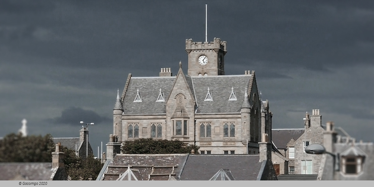
Fort Charlotte was built in the mid 17th century on Lerwick's waterfront, and permanent stone-built buildings began to be erected around the fort and along the shoreline. The principal concentration of buildings was in the "lanes" area: a steep hillside stretching from the shoreline to Hillhead at the top. Lerwick became the capital of the Shetland Islands in 1708, taking over the function from Scalloway. The civil parish of Lerwick had been in 1701 created from a small part of the parish of Tingwall, to which Scalloway still belongs. When Lerwick became more prosperous through sea trade and the fishing industry during the 19th century, the town expanded in 1891 to the west of Hillhead, thereby including the former civil parishes of Gulberwick and Quarff, as well as the island's parish of Burra. Lerwick Town Hall was built during this period of expansion.
Lerwick war memorial dates from 1923 and was designed by Sir Robert Lorimer. The next period of significant expansion was during the North Sea oil boom of the 1970s when large housing developments were built to the north of Staney Hill (located in Lerwick) and to the south (Nederdale and Sandveien).