Le Verdon-sur-Mer
Le Verdon-sur-Mer is a town in southwestern France, located in the Gironde department, in the Nouvelle-Aquitaine region.
Geography
Verdon-sur-Mer has a particular geographical location: triangular in shape, it is located at the meeting point of the Gironde estuary and the Atlantic Ocean, at the northern end of the Medoc peninsula. The town is the northernmost of the Landes de Gascogne. It faces the Charente coast and the town of Royan, 9.5 km1 away, which is accessed by a ferry. Close to Soulac-Sur-Mer, from which it is 5.8 km, it is also 12.7 km from Saint-Vivien-de-Médoc, 28.2 km from Lesparre-Médoc, and 86.8 km from Bordeaux, the departmental and regional prefecture.
History
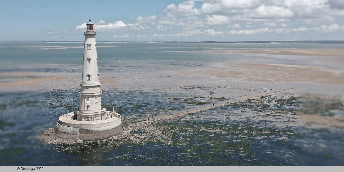
In the eleventh century, the territory of Verdon housed the priory of Saint-Nicolas de Grave, dependent on Cluny. It shelters the monks responsible for the maintenance of the Cordouan fire, off the mouth of the estuary. The priory is buried under the sands for an indefinite period.
Hamlet of Soulac
Until July 1874, Le Verdon depended on the commune of Soulac. 1874 is also the year of the construction of the Bordeaux-Le Verdon railway line which will open up the town and envisage a future port: this one started in sections from Bordeaux in 1868 will not reach Verdon than in 1875 and at the Pointe de Grave in 1902.
The Verdon is therefore at the start only a hamlet of Soulac distant from the Bourg by more than a league (4 km for the Huts, 7 km for Le Verdon-Bourg, about 10 km for the Pointe de Grave) which lives from the production of salt for a very long time (very numerous salt marshes in the Middle Ages). The other main activities of the village are the exploitation of resources linked to the sea (fishing, oysters, shellfish ...) and subsistence farming.
Since the Middle Ages, Le Verdon has been known for its harbor sheltered from the prevailing westerly winds. Ships wishing to leave the Gironde estuary are stationed there before setting out to sea. Ships wishing to refuel on land disembark a few sailors who, with the help of a small boat, go up the Rambaud channel to the village. This channel is also used for shipping salt from the marshes.
In 1717-1723, a royal chapel was built to provide spiritual help to sailors. It bears the name of Notre-Dame-du-Bon-Secours and Saint-Louis. Its construction was financed by a levy on ships entering and leaving the estuary according to their tonnage (decree of the King's Council of 1712). This chapel was abandoned during the Revolution and served as accommodation for officers stationed in the forts of Pointe de Grave. Returned to worship in the 1820s, it was destroyed to be replaced by the current church. The Verdon was set up as an autonomous parish in 1849, separating itself from the parish of Soulac for the celebrations.
A customs post was established in the 1740s to collect the salt tax but also to monitor ships at anchor in the harbor.
Strongly subjected to marine erosion from the middle of the 18th century, La pointe de Grave is the subject of numerous protections against the retreat of the coast. They were initiated by the Ponts et Chaussées, the Gironde maritime service. Between Soulac and the Pointe de Grave, dikes, sea-breakers, and breakwaters are built by the Ponts et Chaussées to retain the sand and break the onslaught of the ocean. 130 years of perpetual construction work stabilize the coastline. The jetty, built in 1844, still bears witness to this, at the end of the Pointe de Grave. Several generations of work are therefore undertaken. The first, from 1839, consisted of the construction of ten groins in Anse des Huttes, very vulnerable due to the narrowness of the dune ridge and the presence of land close to sea level in back. 13 ears of corn are also built between Pointe de Grave and Plage de la Claire. In order to preserve the forest, the engineer Brémontier had set up his first pine seedling workshop at the Pointe de Grave in 1801.
Autonomous municipality
After long procedures, the hamlets of Verdon, Logit, Royannais, Grandes Maisons, Huttes, and Pointe de Grave thus became in 1874 an autonomous municipality called Le Verdon, standing out from the parish of Soulac.
The constructions multiplied in the nineteenth century with the taking of autonomy of the town and the development of the oyster port. In 1882, the cadastre registers count 187 houses, a windmill, and a tile factory in the town of Verdon. This is probably the tile factory demolished in 1885 (plot A 487, belonging to Rigolier in the Logit marshes). In addition, a brickyard was installed on the border with the town of Soulac, at a place called Beauchamp.
XXth century
Since a decree of 1911, Le Verdon has been called Le Verdon-sur-Mer.
The maritime vocation of Verdon-sur-Mer was further reinforced with the inauguration, in 1933, of the port of call, the outer port of Bordeaux. The largest liners of the 1930s docked at this port connected to the land by a viaduct over 340 meters long. Its construction, between 1929 and 1933, attracted a large workforce, often immigrants. Verdon-sur-Mer experienced a period of unprecedented prosperity and its population has never been exceeded since this period. Destroyed in November 1944 by the Germans controlling the Royan pocket and the Pointe de Grave, the port of call was for the time flagship of technology. It accommodates a hundred transatlantic liners during its period of activity. In the years 1966-1986, an oil port was active on the ruins of the old port of call. Three hydrocarbon depots are located in the town, supplying upstream refineries at Ambès (Elf and Esso) and Pauillac (Shell).
This industrialization will affect oyster farming which will be forced to stop in the 1970s (cadmium pollution). If the activity disappears, the huts of the old oyster port have been partly rehabilitated for tourism purposes.
Since the 1980s and the end of the industrialization of the Gironde estuary, Le Verdon-sur-Mer has therefore been committed to tourist development, backed by its heritage and its natural resources (beaches, forests, old marshes salt).
In 2004, Port Médoc, a marina of 800 rings, was opened. It is accessible at all tides. Since its opening, it has received the Blue Flag. In recent years, the tourist vocation of the town has been developing with the construction of tourist residences.
For several years now, prawns have been farmed in the former marshes and since 2014, the production of the Medoc oyster, matured in the marshes, has been started again.