Khor Fakkan
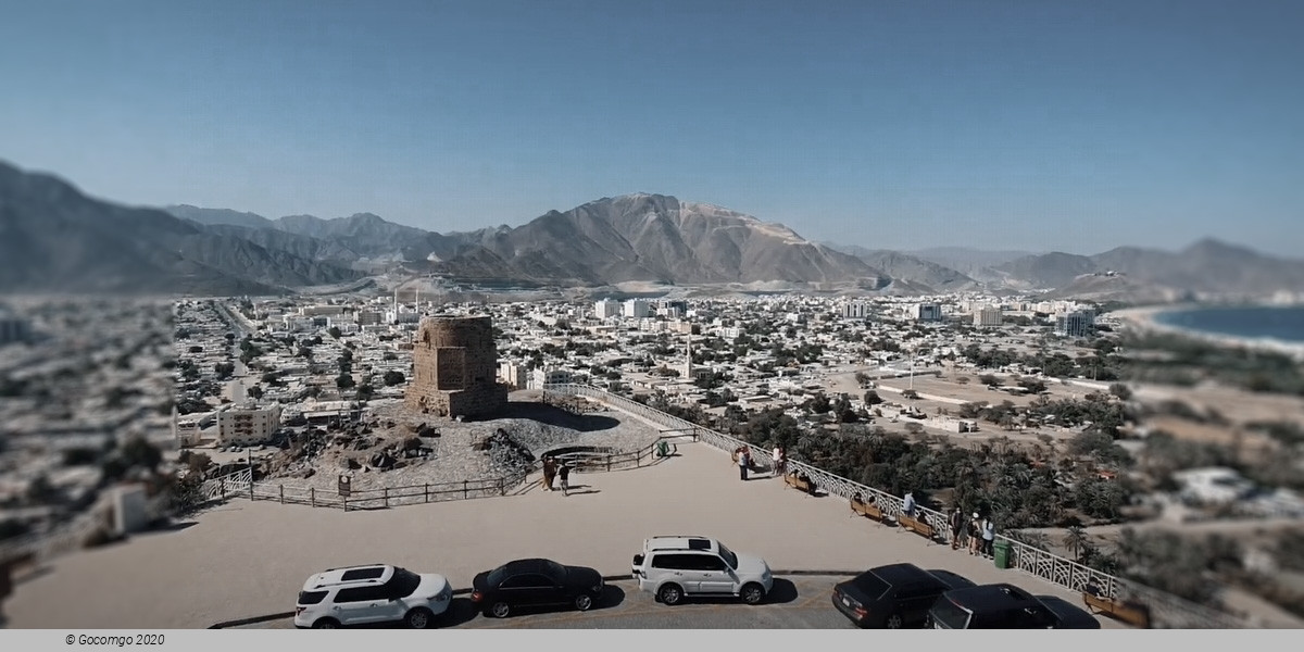
Khor Fakkan is a city and exclave of the Emirate of Sharjah, located on the east coast of the United Arab Emirates (UAE), facing the Gulf of Oman, and geographically surrounded by the Emirate of Fujairah. The city, the second-largest on the east coast after Fujairah City, is set on the bay of Khor Fakkan, which means "Creek of Two Jaws". It is the site of Khor Fakkan Container Terminal, the only natural deep-sea port in the region and one of the major container ports in the UAE. It is also a popular spot among domestic tourists.
History
Khorfakkan has a long history of human settlement. There is evidence of post holes from the wooden uprights of the traditional barasti huts known as areesh, similar to those found at Tell Abraq which dates from the 3rd to 1st millennium BC. Excavations by a team from the Sharjah Archaeological Museum have identified 34 graves and a settlement belonging to the early-mid 2nd millennium BC. These are clustered on rock outcrops overlooking the harbor.
Around 1500, Duarte Barbosa described it as a village “around which are gardens and farms in plenty”. The town was captured by the Portuguese Empire in the 16th century and was referred to as Corfacão. It was part of a serial of fortified cities that Portugal had to control the access to the Persian Gulf and the Gulf of Oman, like Khor Fakan, Muscat, Sohar, Seeb, Qurayyat, and Muttrah. The settlement, located on the east coast of the Musandam peninsula, south of the Gulf of Oman, was a tributary of the kingdom of Hormuz. At the dawn of the 16th century, it and its port were defended by a wide walled belt facing the land, closing the gorge that, in the mountain range parallel to the coast, allows communication with the interior. In this monumental structure, a single door was torn, defended by a tower. The ensemble was responsible for safeguarding eventual tribal attacks.
In 1580 the Venetian jeweler Gasparo Balbi noted "Chorf" in a list of places on the east coast of the United Arab Emirates, which is considered by historians to indicate Khor Fakkan. The Portuguese built a fort at Khor Fakkan that was a ruin by 1666. The logbook of the Dutch vessel the Meerkat mentions this fort and another one, describing "Gorfacan" as a place on a small bay, with about 200 small houses built from date branches, near the beach. It refers to a triangular Portuguese fortress on the northern side, in ruins, and a fortress on a hill on the southern side, also in ruins, without garrison or artillery. As well as date palms, the Meerkat's log also mentions fig trees, melons, watermelons, and myrrh. It notes several wells with "good and freshwater" used for irrigation.
One reason suggested for the ruinous state of the forts is an invasion in 1623 of the Persian navy under the control of Omani Sheikh Muhammad Suhari. Suhari, facing a Portuguese counter-attack, withdrew to the Portuguese forts, including that of Khorfakkan. When the Persians were expelled, the Portuguese commander Rui Freire urged the people of Khorfakkan to remain loyal to the Portuguese crown and established a Portuguese customs office as well.
In 1737, long after the Portuguese had been expelled from Arabia, the Persians again invaded Khor Fakkan, with some 5,000 men and 1,580 horses, with the help of the Dutch, during their intervention in the Omani civil war. In 1765 Khor Fakkan belonged to a sheikh of the Al Qasimi, Sharjah's ruling family, according to the German traveler Carsten Niebuhr. There is a map by the French cartographer Rigobert Bonne dating to about 1770 that shows the Arabian Peninsula and the Persian Gulf and includes Khor Fakkan.
At the turn of the 19th century, Lorimer notes that Khor Fakkan had about 5,000 date trees and was home to about 150 houses of Naqbiyin and Arabicised Persians, amounting to some 800 people. The population lived by cultivation and pearling and the town had seven shops.
The German submarine U-533 sank about 25 miles (40 km) off the coast on 16 October 1943 during World War II. Divers found the wreck at a depth of 108 meters (354 ft) in 2009.